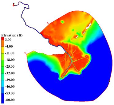
Lower Mississippi River Modeling

Dynamic Solutions, LLC staff constructed a 2-D ADH hydrodynamic and sediment transport model for a 130 mile stretch of the Mississippi River from Carrollton to the Gulf of Mexico. The hydrodynamic model has been calibrated and verified under several different flow and tidal conditions using stage data collected from 14 stations and discharge observation data obtained from USACE New Orleans District on the Mississippi River main stem and its distributaries.
The model aims to elevate understanding of the Lower Mississippi River and Delta (LMRD) system in order to assess the performance of proposed diversion structures and improve management of the system. The model has sufficient spatial and temporary resolution to capture the primary system processes and is able to provide quantitative assessments of sediment transport to investigate impacts of sediment diversions and relative sea level rise. The model results can be used to properly site diversion locations and inform the design of structures to maximize sediment withdrawal.
Return to the ADH Page
